

Bermuda 100 Challenge: Preserving Shipwrecks, Pixel by Pixel
Published Date
By:
- Tiffany Fox
Share This:
Article Content
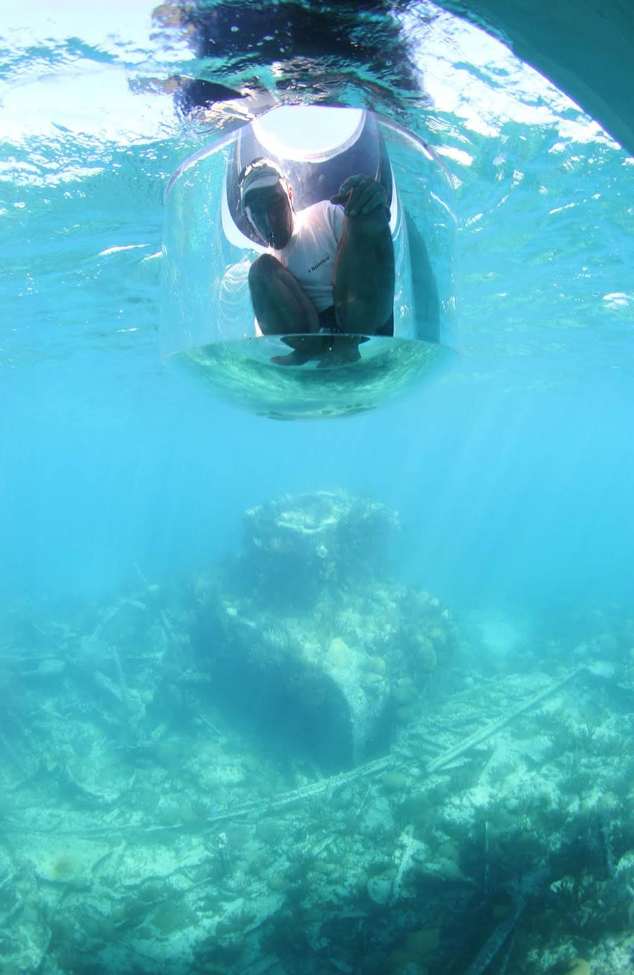
Staying dry while in the water, an explorer hovers over the wreck of the HMS Montana from a wreck-finding drone lowered into the water from a vessel on the surface. The Montana, a side-paddlewheel steamerr, sank in December 1863 after running into shallow reefs off Bermuda’s northwest coast.
What if you could go on a digital dive to experience shipwrecks and other maritime heritage?
This is exactly what a team of engineers, scientists and archaeologists are planning to make reality as they launch the Bermuda 100 Challenge, an ambitious campaign to document at least 100 ships and artifacts as well as culturally and naturally significant sites in Bermuda’s shallow reefs.
Researchers from the University of California San Diego, collaborating with the Bermuda government, nonprofit agencies and other partners in the region, aim to create a comprehensive digital atlas of shipwrecks and natural habitats in Bermuda’s waters – an historical crossroads of shipping between the United States, Europe and the Caribbean. Using advanced underwater, aerial and satellite imaging tools, the team will record the wrecks and related artifacts to construct three-dimensional digital re-creations of the archaeological sites (including 3D video fly-throughs and interactive 3D computer models) without removing artifacts or disturbing the ecosystems.
On March 25 at TEDx Bermuda, UC San Diego professor Falko Kuester officially launched the Bermuda 100 Challenge, and the island’s primary newspaper, The Royal Gazette, called it a “trailblazing project to digitally map Bermuda’s sunken treasure of shipwrecks.”
In his presentation to the TEDx conference – with Bermuda’s prime minister and other dignitaries in attendance – the structural engineering and computer science professor unveiled the Bermuda 100 website, including 3D computer models and digital video flythroughs of three shipwrecks in Bermuda’s waters: the Mary Celestia, the Blanche King, and the Montana.
“This is an interactive 3D model built off of tens of thousands of photographs, not just video,” Kuester told his audience. “We want to allow you to go there and discover it for yourself” – from a computer anywhere in the world.
From the TEDx Bermuda stage, Kuester and his colleagues gave the audience a live demonstration: linking the three already-scanned wreck sites, zooming in and out of their remains on the ocean floor. The flythrough took viewers on a real-time tour of 3.5 billion data points scanned so far.
The live demo went off without a hitch, according to UC San Diego computer science Ph.D. student Vid Petrovic, a visualization researcher in CISA3-CHEI. “Just imagine that the 3.5 billion data points had to be rendered and displayed 30 times every second,” Petrovic observed. “Rendering 100 billion data points per second, points which can be freely interacted with, is unprecedented on the shoebox-sized computer we could fit into our carry-on luggage.”
Kuester called the live demo “Big Data Science at unprecedented scale” that represented the beginning of “a massive, passive sensor network, precisely capturing longitude, latitude, depth and color of site-specific information” that will be very useful in the long run for conservation. “The sensor network is providing a baseline of as-is conditions,” noted Kuester. “They will allow us to study changes at each site, including deterioration, the growth of coral, and transport of sediment, among others.”
In connection with TEDx Bermuda, the UC San Diego team and their partners in Bermuda offered a hands-on experience with the Bermuda 100 Virtual Reality Showcase between TEDx sessions. Visitors were able to chart their own 3D VR expeditions using a game controller to interact with the full-scale model on a 75-inch passive- stereo display.
A Living Ocean Laboratory
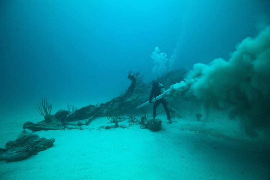
A diver investigates the Mary Celestia, a shipwreck off the coast of Bermuda. The ship once operated as a blockade runner for the Confederacy to transport banned goods in and out of Confederate ports while trying to break the Union’s blockade of the South during the Civil War. Photo by Chris Burville
Bermuda is a literal ocean laboratory on the western edges of the Atlantic’s Sargasso Sea. It has been the locale of some of the greatest developments in marine science and exploration: the expedition of the HMS Challenger (1873-1876), which discovered 4,000 unknown species; naturalist William Beebe’s deep-sea dives in the 1930s enabled by the newly-developed Bathysphere; and the Bermuda Atlantic Time Series, the world’s longest-running marine science ocean analysis, which is hosted at the Bermuda Institute of Ocean Sciences.
The island is surrounded by a large fringing coral reef ecosystem, the most northerly in the Atlantic. The Gulf Stream – the warm-water current that flows north to Bermuda from the Caribbean – allows corals to grow, and diverse plant and animal communities to flourish. The reef has protected the island from the ocean wilderness that surrounds the island, but has also been a center of human tragedy, claiming more than 300 shipwrecks since the 16thcentury.
Researchers say the reef appears, for the time being, to be resilient to changes brought on by shifts in climate that are deeply affecting other coral reef systems around the world.
“Nevertheless, this unique ocean environment is changing rapidly due to human interference and extreme weather events,” said UC San Diego structural engineering and computer science professor Falko Kuester, ““Preserving these historically important shipwrecks requires immediate action.”
Continued Kuester: “Shipwrecks become naturalized components of the benthic [sea-bottom] ecology. Their stories tell of human misadventure and tragedy, yet they create new worlds of discovery for marine scientists and students. Currently some photos and videos exist, and some artifacts were found, but there is very limited mapping or visualization of these shipwrecks.”
Kuester – who directs the UC San Diego Qualcomm Institute’s Cultural Heritage Engineering Initiative (CHEI) and its Center of Interdisciplinary Science for Art, Architecture and Archaeology (CISA3) – is leading UC San Diego participation in the Bermuda 100 Challenge together with CISA3 Special Projects Coordinator Dominique Rissolo and Philippe Rouja, the Bermuda government’s Custodian of Historic Wrecks.
The project was conceived and initiated by Rissollo and LookBermuda director Jean-Pierre Rouja as the first phase of their collaboration with UCSD to leverage disruptive technologies for documenting and participating in conservation, exploration and educational outreach whilst showcasing Bermuda's cultural heritage and natural history assets as part of their Nonsuch Expeditions.
“Embedded in our reef,” added Philippe Rouja, “are shipwrecks from almost every nation and vintage. Some are highly visible and others have been completely reclaimed by nature. Creating a system that not only records where we are at today but also tracks changes over time will allow us to share this history with the broadest possible audience and document and conduct research to help us better understand the interface of human activity and natural reef ecosystems.”
Time Capsules and Testbeds
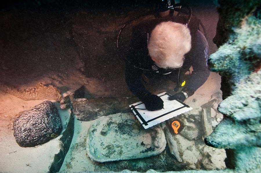
A diver examines the wreck of the Mary Celestia. Photo by Tane Casserly
One shipwreck that has already drawn the interest of archaeologists, marine biologists and divers alike is the Mary Celestia, an iron-hulled steamship from the American Civil War that sank in 1864. In 2011, Rissolo worked with Philippe Rouja, archaeologist James Delgado and LookBermuda | LookFilms to document the rapid excavation of the Mary Celestia. That excavation the subject of an upcoming PBS film was the inspiration for the Bermuda 100 project, and Rissolo noted the team “will be working with our colleagues in Bermuda to launch this bold initiative.”
Kuester and Rissolo say the value in documenting these shipwrecks goes well beyond tourism. The wrecks serve as time capsules of human history, while also sustaining thriving marine ecosystems. For engineers, however, they also provide a testbed for emerging technologies.
Accessing and documenting these underwater sites is a complicated feat for engineers. It involves LiDAR laser scanning to capture point-clouds, high-resolution photography, photogrammetry as well as structure-from-motion to convert two-dimensional images into 3D computer models. These tools and techniques pose new challenges underwater, especially in Bermuda. Most of the shipwrecks are located in its shallow waters, where the interaction of sunlight, water and sediments creates unique difficulties for the creation of accurate and visually expressive 3D models.
“We are developing an improved workflow for underwater site documentation, raising the bar in the world of marine archaeology,” explained Rissolo. “We hope to bring advanced technology to these amazing underwater heritage sites. Falko Kuester has been building student-driven groups of engineers who are passionate about cultural heritage. As an archaeologist, I was incredibly drawn to that.”
“The Qualcomm Institute’s unique combination of talent and skill can supercharge large-scale studies like this,” remarked Kuester. “We’re good at creating teams and pipelines to handle this kind of data-centric exploration.”
Geoffrey Gardner, Deputy Chair of Bermuda’s Historic Wrecks Authority commented: "This technology makes shipwrecks accessible in ways we could only imagine a decade ago. Diving is the best way to experience our shipwrecks and reef, but this gives access in a way that diving can't. The scope and detail in these images is more than you could ever see in a single, or even a series, of actual dives underwater. It is incredibly valuable for the monitoring and protection of Bermuda’s beautiful and priceless natural and cultural landscapes."
Connecting with Natural and Cultural History
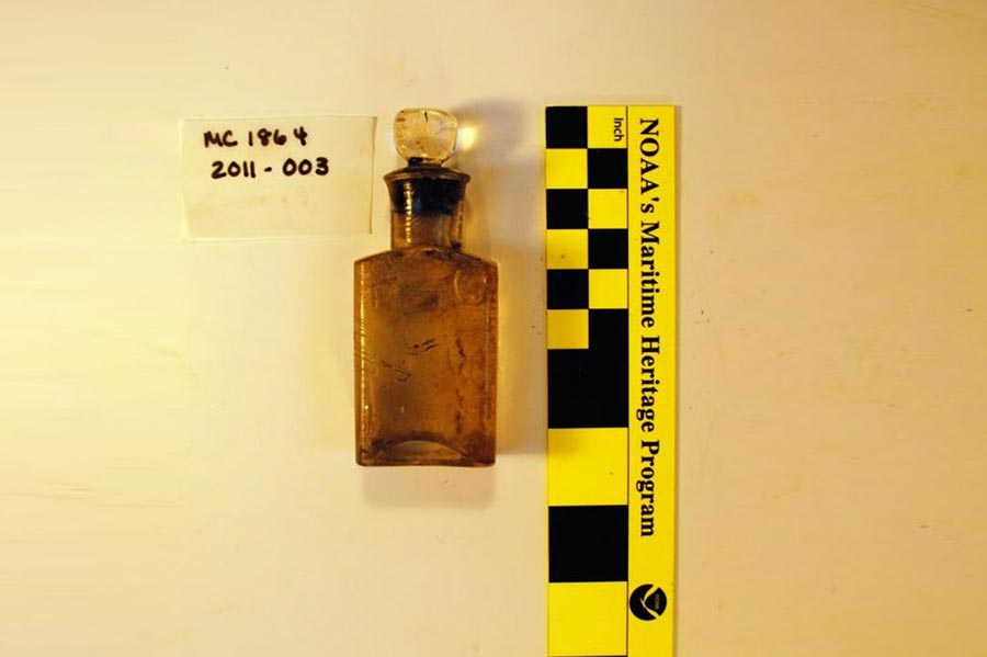
A measuring bottle artifact discovered in the bow of the Mary Celestia. Photo by Tane Casserly
After the shipwrecks are captured with high-resolution, underwater imaging, researchers at UC San Diego take the raw data and images and turn them into digital re-creations.
There is a “whole range of possibilities that will bring these shipwrecks to life,” noted Rissolo. “The documentation could be used for anything from ecotourism and augmented-reality apps to the advancement of marine biology research, all promoting human connection to the natural and cultural history of Bermuda."
Philippe Rouja considers Bermuda “the perfect beta site to conduct interdisciplinary marine studies,” noting that the response of Bermuda’s reefs to the changes being measured in the oceans around Bermuda “is the key to developing recovery and perhaps even repair methodologies to reef systems under threat to our south and around the world.”
The Director of Bermuda’s Department of Environment and Natural Resources, Andrew Pettit, remarked that the government of Bermuda “is entirely supportive of this project.”
“Our reef and wrecks are precious to us,” added Pettit. “Bermuda has a long track record of innovation in marine conservation and science, and working with UC San Diego will allow us to drive policy and management decisions with the best data available. The issues we are confronting are the same all over the world, and Bermuda is ready to play its part in communicating the risks, the opportunities and hopefully the methods for resolving current and future challenges. Data-driven decision-making has always played a big part of that – working with UC San Diego is a golden opportunity for us.“
TEDx and Beyond
The pace at which the Bermuda 100 Challenge documents wreck sites will depend ultimately on fundraising. After unveiling the project at TEDx Bermuda, Kuester met with potential donors – including teams from around the world who are converging on Bermuda for the start of the America’s Cup races – to help defray the costs of deploying teams of UC San Diego students and local collaborators with the best available technology to document each shipwreck.
As the digital reconstruction of the shipwrecks progresses, the hope is that people will take a more vested interest in these sites, learning about their unique environments – without removing their artifacts. “This is a philosophy toward maritime heritage that we would like to spread globally,” said Kuester, “and Bermuda has a very strong track record of doing exactly that."
Share This:
You May Also Like


Stay in the Know
Keep up with all the latest from UC San Diego. Subscribe to the newsletter today.