

By:
- Anthony King
Published Date
By:
- Anthony King
Share This:
Getting the Bigger Picture
Students benefit from invaluable access to satellite imagery through Big Pixel Initiative
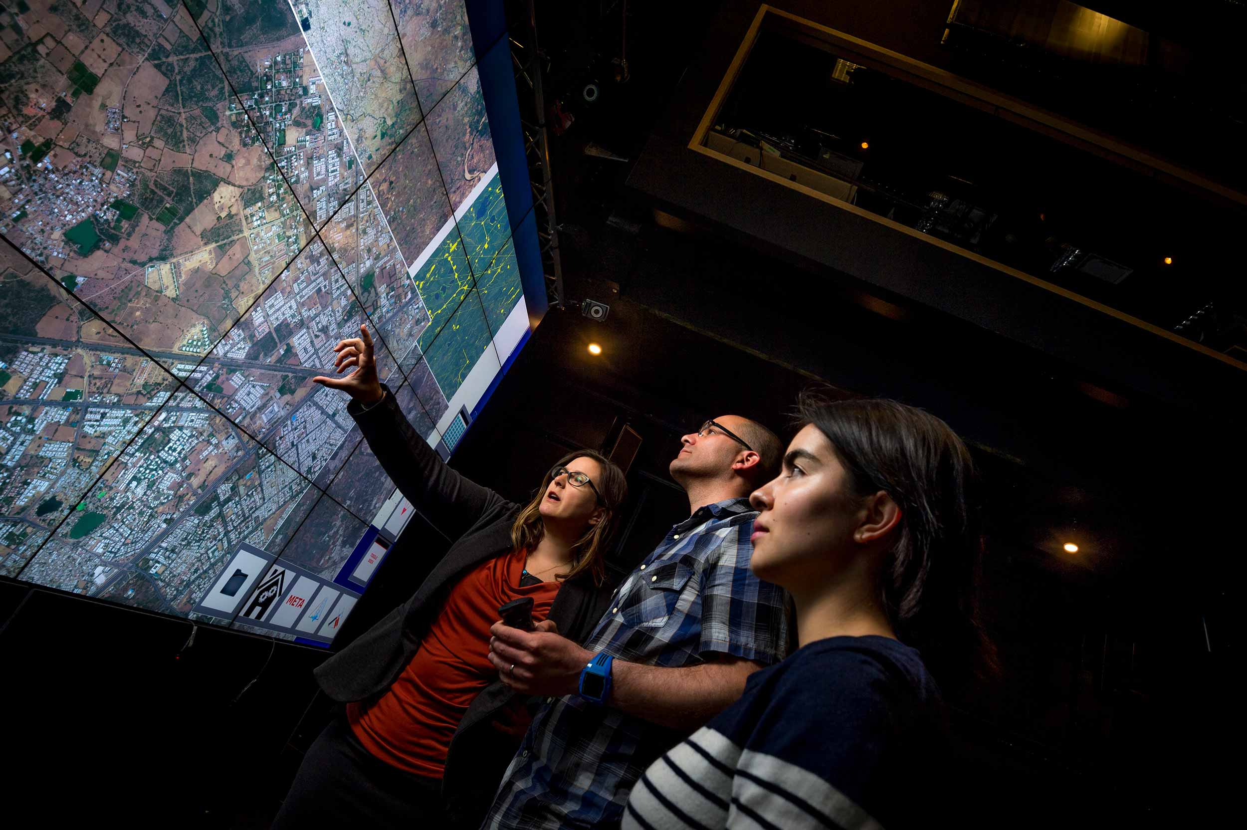
From left, Jessica Block and Ran Goldblatt of the Big Pixel Initiative with School of Global Policy and Strategy student Karla Yee-Amezaga (in front). Photos by Erik Jepsen/UC San Diego Publications
UC San Diego’s Big Pixel Initiative is taking full advantage of a partnership with DigitalGlobe—and the latest Google technology—to sponsor cutting-edge, innovative research. But the applications aren’t just for the researcher. Students across campus are being taught to understand the technology that affects our lives, every single day. And in the process, they’ll graduate more prepared for jobs that have the potential to make positive, real-world change.
In the School of Global Policy and Strategy’s advanced spatial analysis class, students are first given an overview of remote sensing and mapmaking. They study how to build databases, design maps and perform remote analysis. Big Pixel Initiative post-doctoral researcher Ran Goldblatt, who teaches the class, said the demand for professionals with advanced Geographic Information Systems, or GIS, knowledge is definitely going to increase.
That’s because we use GIS every day. It’s used in the GPS function on our smartphones to show us where we are and what’s around us. It’s used in tracking and positioning emergency vehicles. It’s used by retailers and insurance companies to monitor shoppers and calculate prices. And it’s used by urban planners and policymakers to better understand the consequences of new infrastructure and regulations at both local and global scales.
GIS deals with capturing and understanding geographic, or spatial, data, and is essential to understanding most aspects of our everyday life. Learning how to manipulate this huge amount of information—for the Big Pixel Initiative, high-resolution images with additional spatial data—is crucial to working in the future. The United States Department of Labor says GIS-related jobs are projected to grow by 29 percent in six years, much faster than the average 11 percent for all other occupations.
“Spatial analysis on this level is a huge advancement for research, certainly, but the real-world applications are innumerable,” said Gordon Hanson, co-director of the Big Pixel Initiative and professor at the School of Global Policy and Strategy. “For our students, who have a keen eye to tackle global issues after they graduate, the GIS courses set them up for continual success.”
Led by Hanson and Albert Yu-Min Lin of the Qualcomm Institute, the Big Pixel Initiative’s mission is to develop advanced geospatial capacity to address the world’s greatest challenges. Anthropologist Thomas Levy of the Division of Social Sciences applies remote sensing analysis for archeological research, David Kline of Scripps Institution of Oceanography is mapping coral bleaching, and Jennifer Burney of the School of Global Policy and Strategy is developing methods to assess ecosystems in semi-arid regions. These projects are the perfect lab for students to learn how to conduct research, Goldblatt said.
The initiative was launched in 2015 by unique, two-year access to DigitalGlobe Foundation data, and then expanded to include analysis on the new Google Earth Engine platform. In all, there are 10 projects currently underway, in addition to the courses in advanced spatial analysis.
“The partnership with DigitalGlobe is exactly what the Big Pixel Initiative had hoped for, and being able to efficiently analyze data through Google’s platform helps immensely,” Hanson said. “For researchers, it has brought a new level of understanding for our work, but being able to teach our students with these tools is invaluable.”
The student’s final projects in Goldblatt`s class were far-reaching and diverse, he said, demonstrating that remote sensing analysis is fundamental for research in almost any discipline: ecology, economics, human rights, urban and regional planning, archeology and more. Di Dai studied urbanization in India and Karl Rubio looked at the impact of climate change on fire risk in California. William Honaker evaluated foreign investment in North Korea, and Brady Liss, an anthropology graduate student, tested the potential role of Google Earth Engine in archeological research, identifying sites in the Faynan region of Southern Jordan.
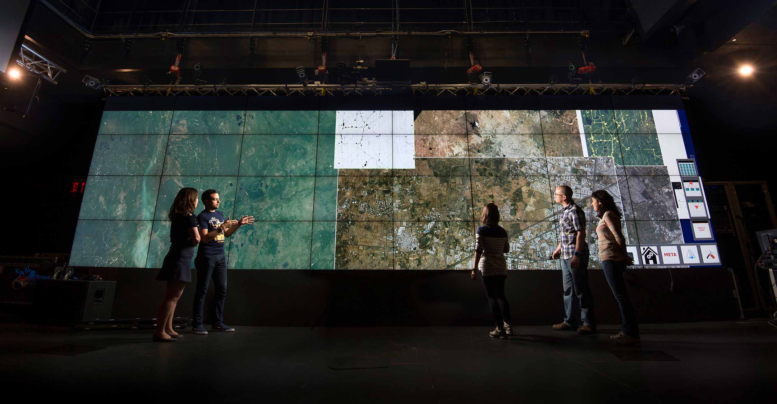
From left, Big Pixel Initiative research assistants Di Dai and Alexis Rivera-Ballesteros watch as Karla Yee-Amezaga, Ran Goldblatt and Stephanie Vallarino study high-resolution satellite images.
For his research, Goldblatt is working with Big Pixel Initiative lead coordinator Jessica Block on understanding the environmental and economic aspects of hydraulic fracturing, or “fracking.”
Goldblatt is clear he is not teaching students how to maneuver Google’s product, but rather how to use existing data to provide solutions to global issues they are passionate about. These skills, he said, are lifelong, and tremendously valuable.
Alexis Rivera-Ballesteros, a Global Policy and Strategy student earning his Master of International Affairs, outlined prospective wind-farm locations in Mexico for his final project. In doing so, not only is Rivera-Ballesteros addressing current issues, but he is also setting himself up for a successful future. He said he intends to use this final paper in job interviews in the nonprofit sector after graduation.
“It was exciting to learn about remote sensing techniques to analyze different land covers and changes through time,” said Rivera-Ballesteros, who is also a research assistant for the Big Pixel Initiative helping Goldblatt and Block locate fracking wells in different regions. “Now, I feel confident about doing spatial and temporal analysis anyplace on Earth.”
Originally from Mexico, Rivera-Ballesteros has focused his learning on energy, economic development and business. He said he tries to link his studies to his native country, looking for ways to help its development. Understanding the basic concepts of economics, he has been looking for different ways to link the public and private sectors to create benefits for the greater society.
“The use of these tools has opened a new horizon for me that I never thought about. I discovered a new passion in me,” he said.
Goldblatt said Rivera-Ballesteros was successful in his project because he was asking the right questions, which led him to finding the correct data and, ultimately, combining that data into the right formula for solving a problem. It’s why Goldblatt encourages the students to investigate issues they care about, and why Rivera-Ballesteros will have many options when he graduates from UC San Diego this year.
“These tools, combined with my quantitative and analytical skills learned at the School of Global Policy and Strategy, make me feel more prepared to apply for a wide variety of jobs,” Rivera-Ballesteros said. “I could even continue my research on energy production suitability for different regions, and replicate that in places all over the world.”
Share This:
You May Also Like


Stay in the Know
Keep up with all the latest from UC San Diego. Subscribe to the newsletter today.