
By:
- Lauren Fimbres Wood
Published Date
By:
- Lauren Fimbres Wood
Share This:
Wildfire Watch
UC San Diego partnership with SDG&E adds high-def Camera System in San Diego’s Back Country
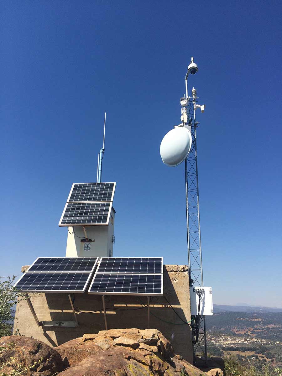
A solar-powered camera station on top of Big Black Mountain in San Diego County. The camera has near infrared, pan-tilt-zoom and night vision capabilities.
According to CalFire, the State of California has experienced nearly 6,500 fires since the start of the year. This marks a 40 percent increase over the same period in 2016. With a longer fire season becoming the new norm, wildfires are a growing hazard facing the entire state.
Over the last decade, a collaborative team of researchers at UC San Diego built a network across areas most prone to wildfires in San Diego’s back country, creating a multi-hazard detection system with a microwave communications network, seismic sensors, wildfire monitoring, meteorological capabilities and more.
Last week, San Diego Gas & Electric (SDG&E) announced a major upgrade to this network, with the installation of 15 high-definition cameras that will now offer a live-streaming view of San Diego’s most fire-prone areas. The new Alert SDG&E Cameras have live video, show time-lapse scenarios, and can pan-tilt-zoom. They also use near-infrared capabilities for night vision and can link to incident command centers to notify fire officials when a plume of smoke appears. Researchers are currently working on the capability for the cameras to utilize machine vision to detect smoke.
The camera system, developed by the Seismological Lab at the University of Nevada, Reno (UNR), will build upon a larger network already in place in Lake Tahoe and Nevada that has been credited with the early detection of more than 300 fires in the region over the past two years.
This collaboration has public safety and resilience to hazards at the forefront, and local fire agencies have full control of the cameras. This upgraded network provides an extra set of eyes in the field to help improve planning, preparing and responding to wildfire emergencies.
“The safety of my firefighters and the communities they protect is my priority, so having more information about a fire before we encounter it is an added safety measure,” said San Diego Fire-Rescue Chief Brian Fennessy at a press conference at SDG&E’s headquarters last week. “It also helps with safe evacuations. If we’re able to better know where a fire will approach first we can better direct resources and know how to plan evacuations.”
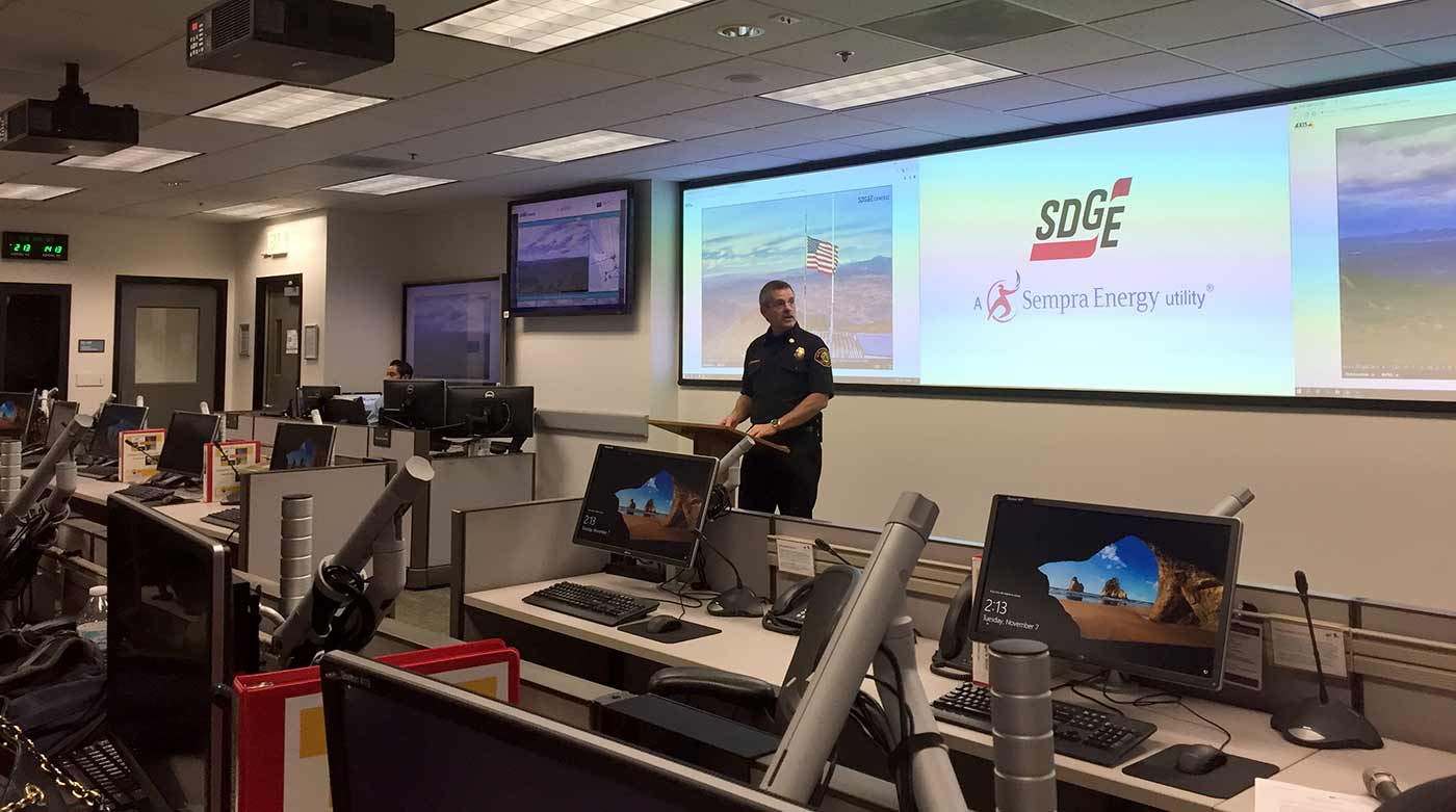
San Diego Fire-Rescue Chief Brian Fennessy unveiled the new cameras at a a press conference at SDG&E’s headquarters last week.
Cameras are located on communications towers in San Diego’s biggest fire threat zones, including Mt. Woodson, Boucher Hill, Otay Mountain, Red Mountain and Lyons Peak. Determining the location of a fire is accomplished by triangulation, the process of focusing different cameras on the fire throughout the Alert SDG&E Camera network. It provides an accurate location for first responders and is revolutionizing fire suppression from reactive to proactive, reducing the potential size, impact, and public costs of wildfires.
These cameras have already proven instrumental in their first weeks of operation. On Oct. 21, the day before a multi-day Red Flag Warning, reports of a wildfire which eventually became known as the “Church” Fire ignited in Campo. Click here to view the time-lapsed video recorded from the Alert SDG&E Cameras.
“This sophisticated set of cameras is providing us with a level of real-time situational awareness we’ve never had before. Not only are we able to zoom in on ignition points using multiple cameras, we can pinpoint almost instant fire proximity and notify first responders,” said Caroline Winn, SDG&E’s chief operating officer. “Having this information at our fingertips could provide critical minutes needed to protect people, power structures and property.”
This upgraded technology builds on a framework originally developed in 2000 by researchers at Scripps Institution of Oceanography and the San Diego Supercomputer Center. The internet-connected cyberinfrastructure known as the High Performance Wireless Reach Network (HPWREN) was used for research, education and public safety. For more than a decade, the HPWREN system captured real-time camera images taken once per minute.
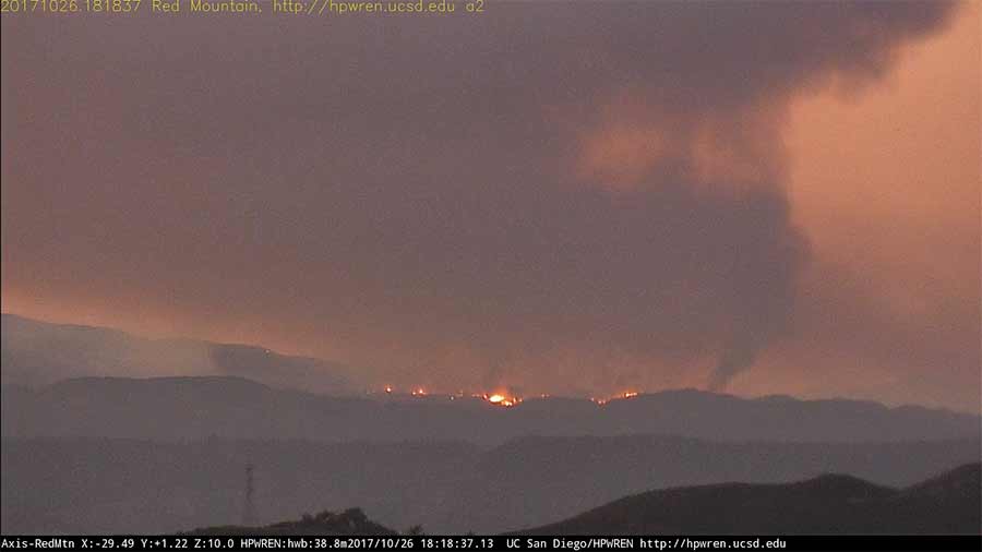
A view of the Wildomar Fire on Oct. 26, 2017, as captured from the new Alert SDGE Cameras on Red Mountain in the Valley Center area of San Diego County.
SDG&E’s team of meteorologists and professors at UC San Diego and UNR worked closely to improve upon the previous system to facilitate increased early wildfire detection. Alert SDG&E Cameras also allows for public access with a user-friendly website, giving residents the ability to monitor conditions within their community.
“This new camera system uses the backbone built by UC San Diego to ensure resilient, redundant communication is in place to prepare for when disasters strike and networks becomes challenged,” said Neal Driscoll, professor of geoscience and geophysics at Scripps Oceanography and principal investigator on Alert SDGE Cameras. “These cameras will immediately be an asset to public safety, and are a great example of university, corporate and civic entities working together.”
San Diego City Councilmember David Alvarez (District 8) also played a key role in granting access to several of these remote areas, so new cameras systems could be installed quickly before the peak of fire season. Fires can occur year-round in California, but the peak season is considered to be April through October, when hot, dry temperatures combine with warm Santa Ana winds, which causes fires to spread fast.
UC San Diego’s role in wildfire detection fits well into one of the university’s core research themes: understanding and protecting the planet. This cross-university collaboration that uses data, technology and geoscience, is just one way UC San Diego is helping to protect the state and make it more resilient to disaster in the future.
Share This:
You May Also Like


Stay in the Know
Keep up with all the latest from UC San Diego. Subscribe to the newsletter today.